Assessing Solar Potential of Buildings Using LiDAR and Footprint Data
Silvia Vangelova
Abstract
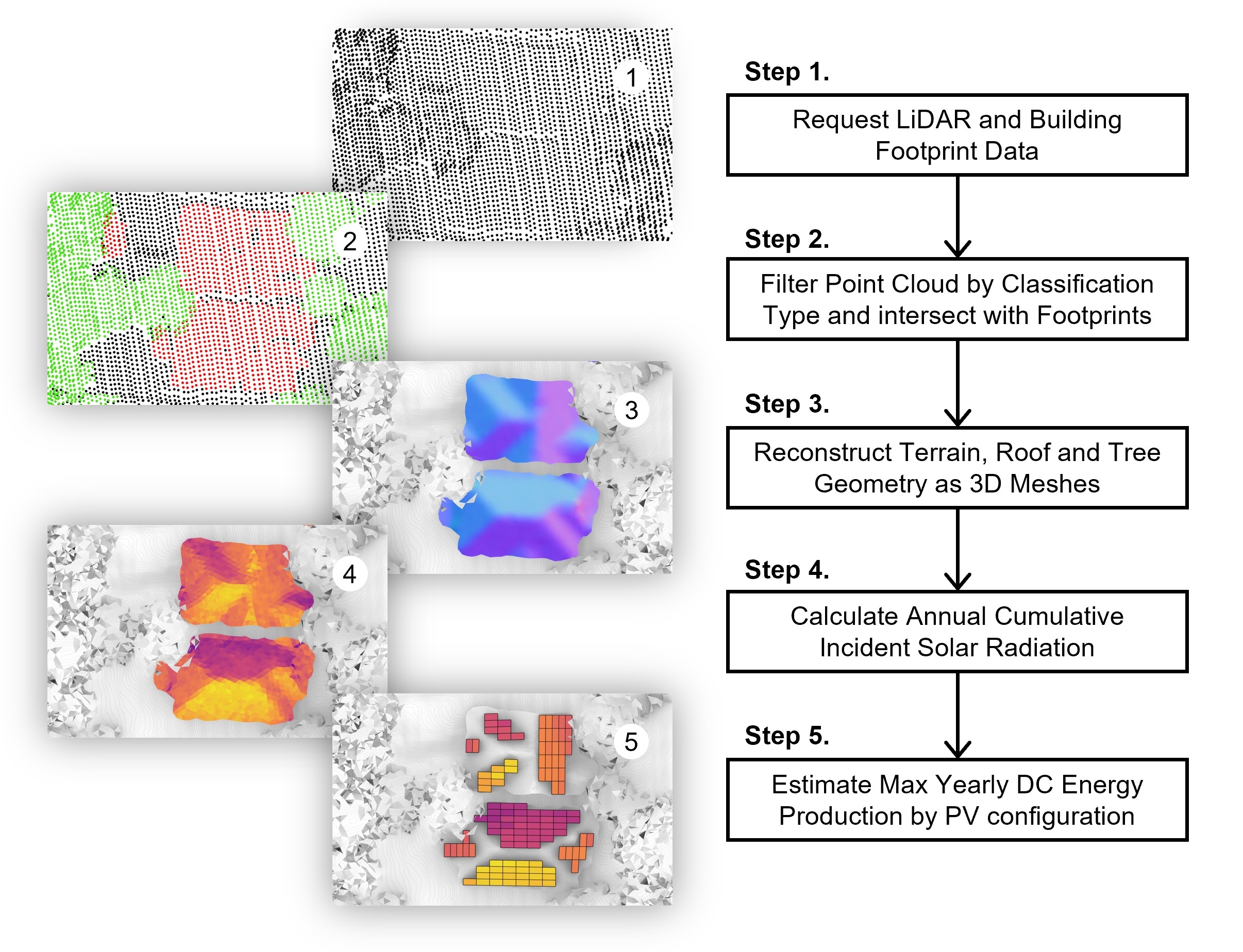
The mass adoption of building-integrated photovoltaics (BIPV) emerges as a promising solution for reducing global greenhouse gas (GHG) emissions. However, using such systems to achieve net zero operational energy at the urban scale requires evaluating the solar potential of thousands of buildings which poses many challenges concerning data availability, quality, and privacy. To address these issues, we present an automated end-to-end framework for querying, combining, and processing publicly available aerial Light Detection and Ranging (LiDAR) and Building Footprint data. Using open-source algorithms for geometry reconstruction and solar radiation analysis, we show how to estimate the maximum annual direct current (DC) electricity yield per building. This framework is designed to enable urban planners, developers, and architects to assess the solar potential of neighborhoods and cities in an accessible way. By enabling effective communication of results, it can help optimize resource allocation and benefit solar adoption initiatives.
Keywords
BIPV, Performance-based design, Photovoltaic potential, Spatial data processing, Renewable energy, Urban planning
Author
-
Name: Silvia Vangelova
-
LinkedIn: Link
-
Institution: Georgia Institute of Technology
-
Program: M.S. Analytics (OMSA)
-
Advisor: Dr. Patrick Kastner
Repository Structure
-
Code/: Directory containing the code, scripts, or notebooks used in the research.-
Grasshopper/: Directory containing the grasshopper definition-
data/: Directory containing data for the grasshoper script
-
-
Notebooks/: Directory containing notebooks-
images/: Directory containing images produces from running the Notebooks -
data/: Directory for storing data produced from running the Notebooks
-
-
-
Resources/: Directory containing images used in this README.md file. -
README.md: This file, providing an overview of the thesis and repository.
Instructions for reconstructing mesh geometry in Jupyter Notebook
Environment set-up:
-
python -m venv env
-
env\Scripts\activate
-
pip install -r requirements.txt
Running the Solar Potential Analysis script in Grasshopper instructions
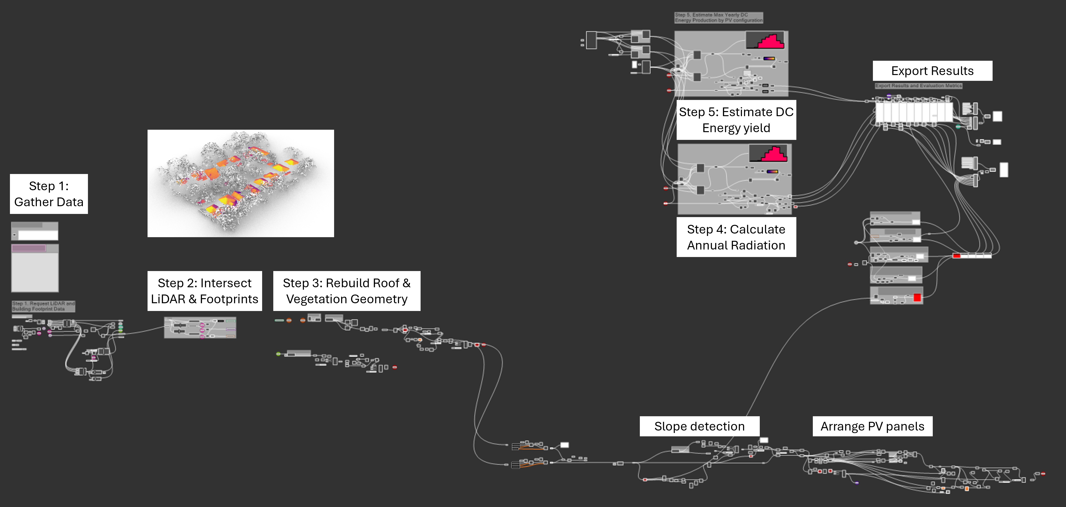
The grasshopper definition is developed in Rhino 8 SR10 (8.10.24228.13001, 2024-08-15) on Windows. For this version, there are certain issues when importing pandas (see forum discussion here)
-
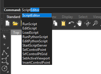
Before starting Grasshopper make, sure to open the ScriptEditor and run the following script to import numpy, pandas, and laspy:
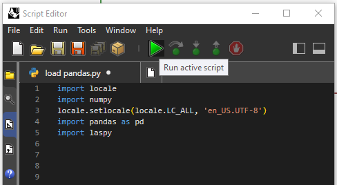
Code snippet:
import locale import numpy locale.setlocale(locale.LC_ALL, 'en_US.UTF-8') import pandas as pd import laspy -
To install Python packages in Rhino 8 you can either install them from the Terminal or use the
# r: %package name%notationUsing Terminal
-
Open command prompt
-
Navigate to script environment, e.g. run:
cd "C:\Users\%UserName%\.rhinocode\py39-rh8\Scripts" -
Instal packages, e.g. run
pip install pandas
Using the
# r: %package name%notation: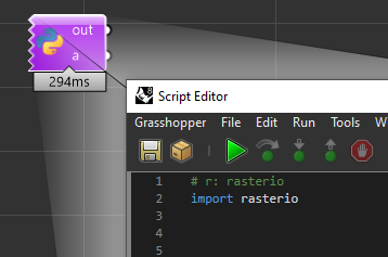
See also this tutorial for using packages in Rhino 8
-
-
To run the script make sure the following packages are installed and can be imported properly:
 rasterio

 laspy

 lazrs

 laszip

 geopy

 scikit-learn

 scipy

 cgal

 requests

 rasterio

 geopandas

 osmnx
Citation
@inproceedings{vangelova2024sigradi,

  title = {A Computational Framework for Assessing Solar Photovoltaic Potential of Buildings Based on LiDAR and Building Footprint Data},

  author = {Vangelova, Silvia and Kastner, Patrick},

  year = {2024},

  booktitle = {Proceedings of SIGRADI 2024},

  institution = {Georgia Institute of Technology},

  bibtex_show = {true},

  preview = {SIGRADI2024.png},

  isbn = 978-9915-9635-2-5

}
Source
Link to the repository.